THIS is April in Minnesota & Wisconsin
The upper Midwest (and, especially, Minnesota) shared in the coldest air in North America on Friday April 6, 2018. Despite a sky full of strong April sunshine highs stayed in the 10s and 20s on a day when the average high in the Twin Cities was 53°.
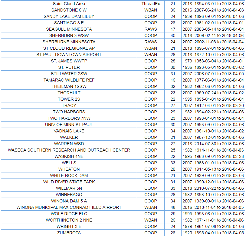
The actual high in the Twin Cities was 26° which tied for the coldest high temperature ever recorded on April 6; the other 26° high occurred on April 6, 1939.
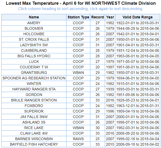
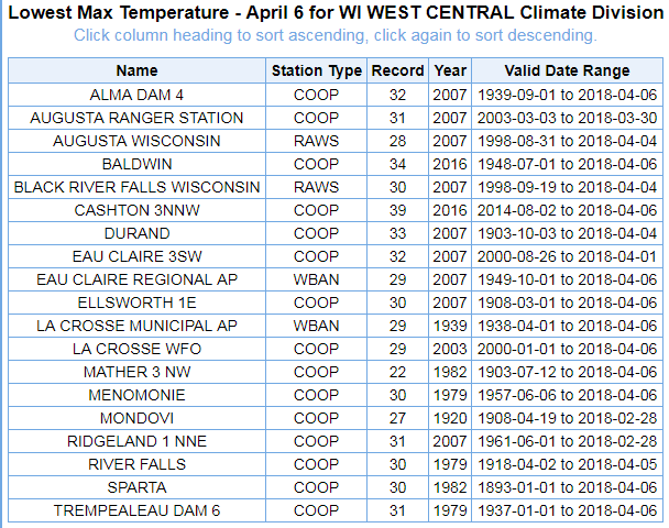
Many other Minnesota towns and cities also set record cold highs this year, and the full list of coldest highs ever recorded in Minnesota and Wisconsin on April 6 is below. If the "YEAR" column contains a "2018" then that location set a record.


Source: NOAA/ARL HYSPLIT
I used the NOAA Air Resources Laboratory HYSPLIT model to calculate where the air originated and, no surprise, our remarkable cold began the week in the northern reaches of Canada and near the North Pole.
Paradoxically, current research suggests that climate change could be making extreme cold outbreaks (and "bomb cyclones) more likely in parts of the United States.
How? The physics is simple. In our warming world the Arctic regions are warming much faster than the U.S. is, leading to less of a temperature differential between the Arctic and mid-latitudes. Temperature differential and winds are correlated -- a larger north-south temperature differential across North America leads to a stronger current of air overhead (called the jet stream); a smaller temperature differential leads to a weaker jet stream. Weak jet streams allow for more north-to-south movement of the coldest air in North America, resulting in more frequent outbreaks of extreme cold farther south.
This is an area of ongoing research and there's still a lot to learn; but, even middle-school physics makes this explanation seem likely.
For now, whatever the reason, we just shiver. Bundle up.